Page summary
EuroBoundaryMap
EuroBoundaryMap is a seamless geo-database at the scale 1:100 000 covering 61 European countries and territories (according to ISO country code and *Kosovo) from 39 data producers. It contains geometry, names and codes of administrative and statistical units continuously updated by our members, the national mapping and cadastral authorities (NMCAs) of Europe. It links to the updated statistical LAU- and NUTS-codes for all local administrative units of the 27 member states of the European Union.
Pricing
Our products are priced according to coverage, number of users and other rights. See our pricing and licensing page.
Basic Information
| Basic information | Current version: 2025 Release date: May 2025 Nominal scale: 1:100 000 Coordinate system: Geographical in degrees (longitude, latitude) with decimal fraction, based on the ETRS89 spatial reference system |
|---|---|
| Database structure | The geometry of administrative units at the most detailed level is stored in a data layer. The boundaries, administrative units on upper hierarchical levels and statistical regions are provided as additional layers. Attributive information is stored in linked tables. |
| Database specification | EBM Specification |
| Delivery formats | GeoPackage ESRI ArcGIS Geodatabase (10.1) ESRI Shapefiles |
| Data structure and content |
|
| Change history | Changes from EuroBoundaryMap 2024 to 2025:
|
| Quality and standards | Data Product Specification compliant to ISO 19131. Quality checked according to ISO 19157, with documented results. Metadata based on ISO 19115 and INSPIRE Metadata Implementing Rules v1.3. Lineage information includes national specifics, processing, and administrative hierarchies. |
Coverage
Dataset includes:
Albania
Austria
Belgium
Bosnia and Herzegovina
Bulgaria
Croatia
Cyprus
Czech Republic
Denmark including the Faroe Islands and Greenland
Estonia
Finland
France including French Guiana, Guadeloupe, Martinique, Mayotte, Reunion, Saint Barthelemy, Saint Martin, Saint Pierre and Miquelon and Monaco
Germany
Greece
Hungary
Iceland
Ireland
Italy including San Marino and Vatican City
Kosovo*
Latvia
Lithuania
Luxembourg
Malta
Moldova
Netherlands
North Macedonia
Norway including Svalbard and Jan Mayen
Poland
Portugal
Romania
Serbia
Slovakia
Slovenia
Spain including Andorra and Gibraltar
Sweden
Switzerland including Liechtenstein
Ukraine
United Kingdom (Great Britain and Northern Ireland)
*This designation is without prejudice to positions on status, and is in line with UNSC 1244 and the ICJ Opinion on the Kosovo Declaration of Independence
Sample data
Sample data are available upon request to oliwia.marszalek@eurogeographics.org
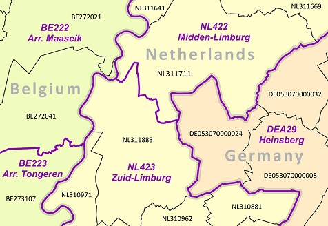
The samples are available for evaluation purposes and are taken from the border area between Belgium, France, Germany and Luxembourg.
The sample data is for internal evaluation purposes only. All are © EuroGeographics
Applications
EuroBoundaryMap 2025 enables you to geo-reference statistical data, and can also be used as a background to geo-referenced datasets.
View some use cases.
The most typical applications of the data are:
- geo-market analysis
- socio-economic analysis
- demographic analysis
- asset management, and
- geo-referencing cross-border data.
Product literature
Contact
For more information about EuroBoundaryMap or any of our products, please contact us.
Licensing
To license any of our products, please visit our Licensing page.